Transportation
Dive into CityViz transportation network website widget, an essential tool for visualizing key transportation networks. Enhance your logistics and connectivity strategies with interactive maps and data, vital for informed decision-making and growth planning.


Access to Major Transportation Hubs
Visualize driving times and distances to urban centers, transportation hubs, and economic hotspots for strategic logistical planning and connectivity analysis. This feature allows businesses and investors to assess the efficiency and reach of road networks, crucial for optimizing supply chains and distribution routes.
Flight Connections
Showcase global and domestic reach with maps highlighting direct flight routes from nearby airports, illustrating your community’s accessibility. Understanding flight connections is vital for industries relying on quick and efficient air transport, helping to attract businesses that depend on international and domestic travel.
Enhancing Community Accessibility
By integrating these transportation insights, our widget showcases your community’s accessibility and connectivity, making it an attractive destination for businesses and investors. The comprehensive data provided helps in making informed decisions about site selection, investment opportunities, and economic development strategies.


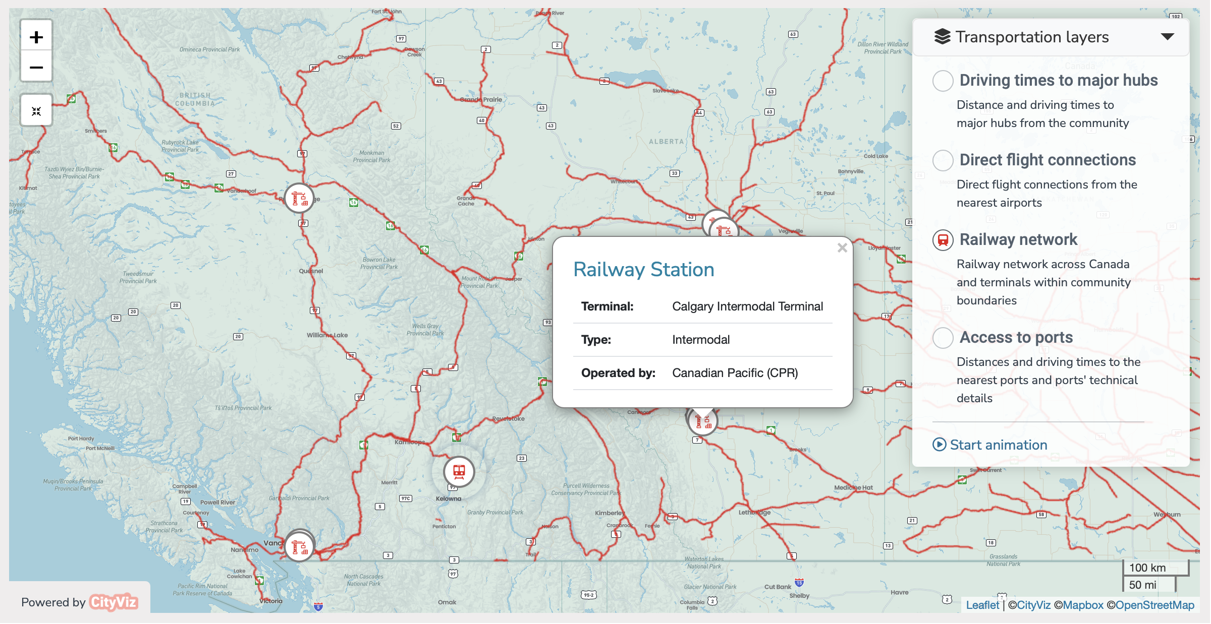
Railway Network
Understand freight and passenger transport options with detailed maps of local railway connections, including major intermodal terminals. This layer provides insights into the rail infrastructure supporting economic activities, which is essential for heavy industries and large-scale manufacturing that require robust rail connectivity.
Ports and Their Capacity
Explore maritime gateways with maps detailing port locations and attributes, crucial for assessing the role of maritime transport in economic growth. Highlighting ports’ capacities and their connectivity to global shipping routes helps attract investors in the import-export sector and businesses reliant on maritime logistics.

"We are delighted to be partnering with Cityviz on this Regional Data Platform. Regional data can assist elected officials and local government staff to make better decisions in other areas as well."
Laurel Douglas, CEO, Economic Trust of the Southern Interior
Logistics & Transportation Gallery

CityViz Logistics & Transportation Widget
Logistics widget is your comprehensive solution for visualizing and understanding the transportation networks and connectivity of your community or region.
With its detailed maps and strategic insights into driving times, flight connections, railway and road networks, isochrones, and ports, this tool equips you with the data needed for advanced planning, investment attraction, and infrastructural development.
Investment Attraction Website Tools
Explore even more widgets currently available, discover how our innovative tools can further support your investment strategies.
Check out our Local Transit website widget for comprehensive insights into transportation networks and connectivity to major transportation hubs, and explore our Market Research widget to gain valuable data on market trends and demographics.